One of the best ways to explore the any island is on bike. A true beach soul rarely goes without a beach cruiser style bicycle at the beach to get them around. Some simply enjoy the feel of the ocean breeze, others the excitement of exploring new island zones and others simply take the opportunity to refresh from reality. Whatever your reason we put together some notes regarding Kill Devil Hills Bike Trails and Paths, including our personal route the “KDH Island Loop.”
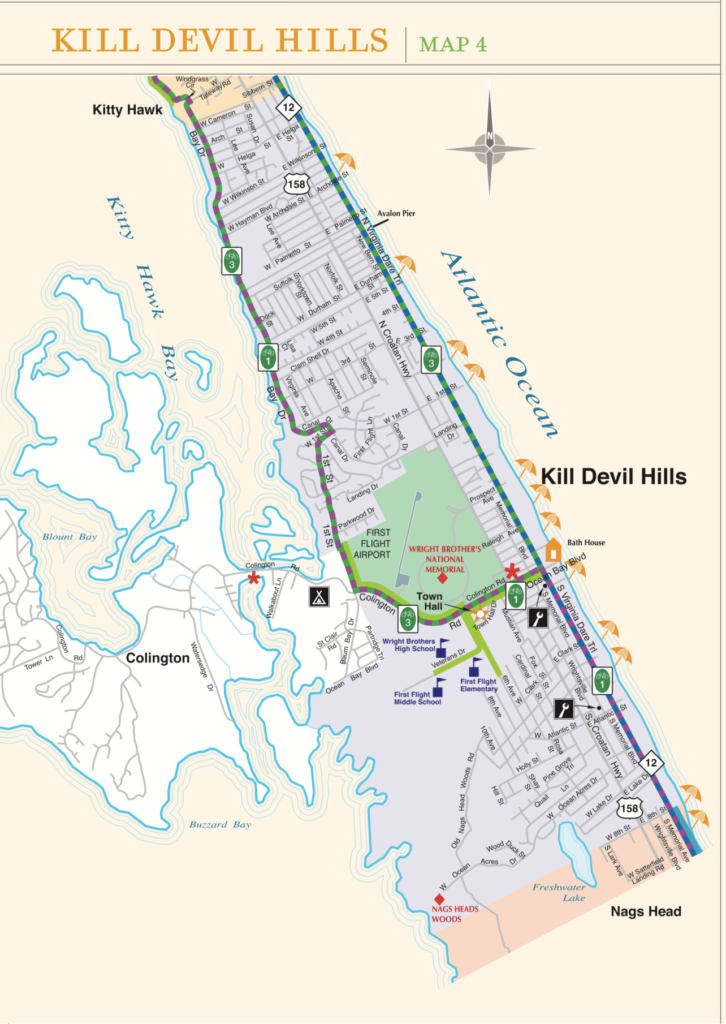
Kill Devil Hills Bike Trails + Maps (City Map)
Multi-use Paths on the Outer Banks
A variety of multi-use paths are available for residents and visitors of Dare County to traverse across towns and villages, providing access to businesses, beach accesses and the soundside. These pathways are generally free from motorized vehicles and separated from vehicular traffic.
This video tells you more about these important recreation facilities.
Island Loop: One of the Best Kill Devil Hills Bike Trails
The Island Loop Bike Trail took a many tries to chart! The idea was to give riders a good safe look at the whole island, like the Palmico Sound and Atlantic Ocean, with a starting and ending point from any of the Live Swell Beach Bungalows. Of course, there are many points of interest and places to stop along the way, like restaurants or the Wright Memorial and Avalon Fishing Pier.
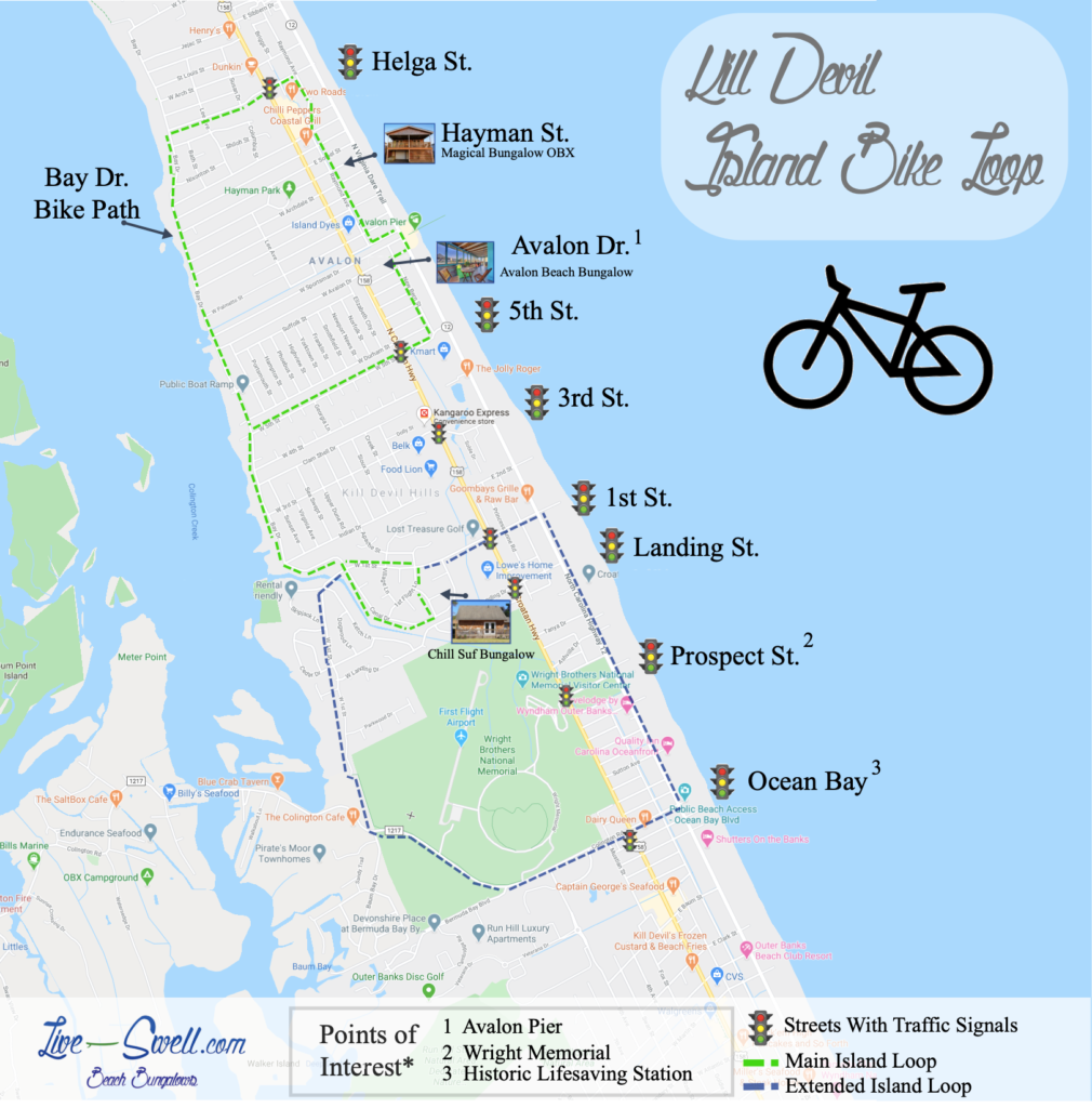
The Kill Devil Island Loop has a Main “Green Line” and an Extended “Blue Line.” The Green Line Island Loop is approximately 4 – 5 miles, the Blue Line Island Loop is approximately 6-7 miles.
Outer Banks Bicycle + Pedestrian Safety
Watch this video to learn important tips and information to help keep you safe on our roadways. This message was brought to you by Dare County and the Outer Banks Bicycle and Pedestrian Safety Coalition.
Notice the Island Loop Bike Map has icons of Traffic Signals throughout the map. This was done on purpose to show the exact street location where to cross Croatan Highway the most safely as possible. We highly recommend crossings are only done at traffic signals, this is particularly important in the summer season when island traffic and occupancy is high.
See Island Loop Map